Jalabhilekh: Mobile application for remote sensing-based surface water identification and monitoring
TRL level:
Technology Demonstration (TRL-4)
Executive Summary/Description of the software
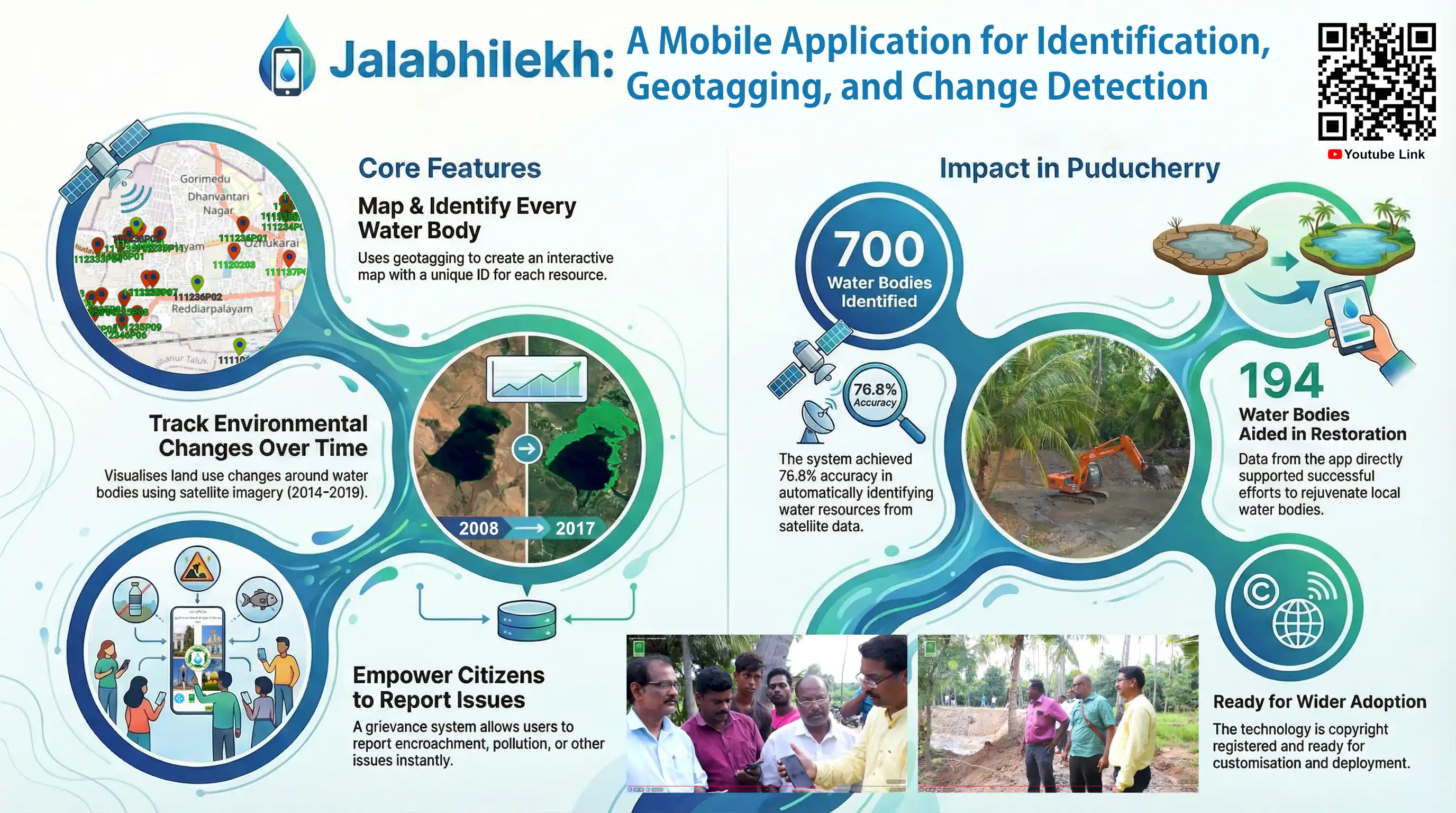
The 'Jalabhilekh' mobile app facilitates public and local authority input for water body identification. A near real-time land use change detection algorithm, integrated with Google Earth Engine and Firebase Cloud Database, successfully identified, and geotagged 700 water bodies in Puducherry with 76.8% accuracy. The Puducherry Government utilized the app to restore 194 water bodies, showcasing its potential for wider global application in water resource management and conservation efforts.
Salient Technical features
Geotagging: Users access water body details like UID, status, and locality via an interactive map using OpenStreetMap.
Know your WB: Allows users to search water bodies by name or unique ID and filter results by region or locality.
Land Use and Land Cover (LULC) Change: Visualizes land use changes around water bodies from 2014 to 2019, soon expanding to 1990-2014 data.
Tour to WB: Offers virtual tours of water bodies with drone-captured videos, enabling remote exploration.
Grievance: Includes a form for users to report issues like encroachment to authorities, promoting community involvement in water body management.